Essential Equipment for Conducting Topographic Surveys
Table Of Contents
Data Collection Methods
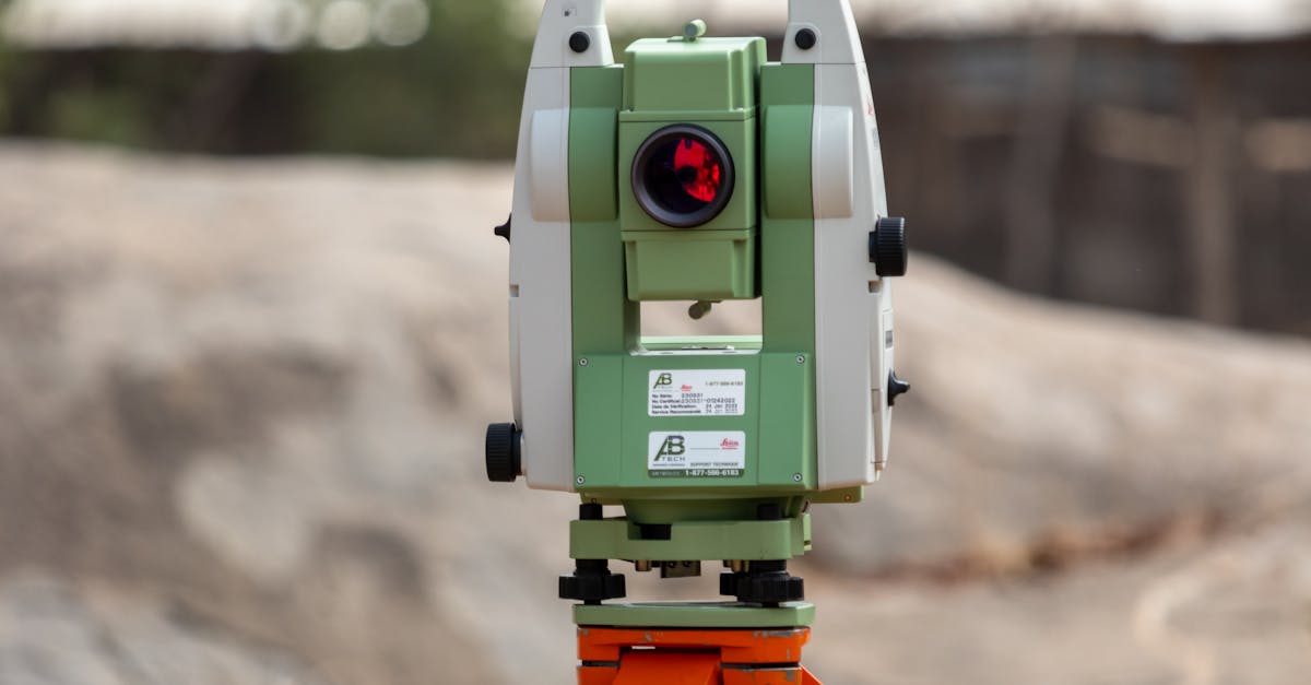
In topographic surveys, various data collection methods play a crucial role in achieving accurate results. Traditional techniques, such as the use of theodolites and total stations, have been utilised for decades. These tools allow surveyors to measure angles and distances with precision. Levelling instruments are also essential for determining height differences across the survey area. Despite the advancements in technology, these conventional methods remain relevant, especially in environments where modern equipment may not be feasible.
Modern data collection techniques have transformed the surveying landscape significantly. The introduction of GNSS (Global Navigation Satellite System) and UAVs (Unmanned Aerial Vehicles) has enhanced the ability to gather data quickly over vast areas. GNSS technology provides real-time positioning data, which increases the efficiency of the surveying process. Meanwhile, UAVs equipped with high-resolution cameras enable the capture of aerial imagery and 3D models. These progressive methods streamline workflows and improve data accuracy, catering to the evolving needs of the surveying industry.
Traditional vs. Modern Data Collection Techniques
Traditional methods of data collection in topographic surveys primarily rely on tools such as theodolites, total stations, and levelling instruments. Surveyors using these techniques must possess a thorough understanding of manual calculations and data interpretation. These approaches can be time-consuming as they often involve physically measuring distances and angles, leading to longer fieldwork hours. However, they have the benefit of honing a surveyor's skills in precise measurements and an understanding of fundamental surveying principles.
Modern data collection techniques have revolutionised the surveying industry with the introduction of technologies like GPS and laser scanning. Equipment such as drones and robotic total stations enable faster and more accurate data gathering, significantly reducing the chance of human error. Advanced software programs assist in processing and analysing large datasets, making it easier for surveyors to visualise information. The adoption of these modern methods increases efficiency and enhances the overall productivity of topographic surveys in various environments.
Surveying Software Solutions
With the advancement of technology, various surveying software solutions have emerged to enhance the accuracy and efficiency of topographic surveys. These programs enable surveyors to process data collected from different instruments seamlessly, providing tools for visualisation, analysis, and reporting. Features often include 3D modelling, geographic information system capabilities, and integration with GPS technology, making it easier for professionals to collaborate and share information.
Surveying software can greatly streamline workflows and improve project outcomes through better data management and analysis. Many solutions come with user-friendly interfaces and extensive support resources, catering to both experienced surveyors and newcomers to the field. The choice of software can depend on the specific needs of a project, as well as budgetary constraints, with a range of options available from industry standards to more niche applications.
Recommended Software for Data Analysis
Numerous software options are available for analysing data collected during topographic surveys. Geographic Information Systems (GIS) software stands out as a powerful tool. It allows surveyors to manipulate and visualise spatial data effectively. Popular GIS platforms such as ArcGIS provide robust functionalities for mapping, analysis, and data management. These tools enable comprehensive interpretation of the survey data, enhancing decision-making processes based on accurate geospatial information.
In addition to GIS applications, other specialised software can assist in the analysis of survey data. Software like AutoCAD and Civil 3D is commonly used in civil engineering and construction projects. These platforms offer features tailored to drafting and modelling, which can significantly streamline the design workflow. By utilising these software solutions, surveyors can integrate their findings into larger projects more efficiently. Accessibility to high-quality analysis tools is crucial for maintaining accuracy and efficiency throughout the surveying process.
Safety Equipment in Surveys
In the field of topographic surveys, ensuring the safety of personnel is paramount. Surveyors often work in diverse environments, which can present various hazards. Essential personal protective equipment (PPE) typically includes hard hats, high-visibility vests, sturdy gloves, and steel-toed boots. In areas where equipment is in use, hearing protection may be necessary to prevent noise-induced damage. Additionally, safety goggles are advisable when working with heavy machinery, while weather-appropriate clothing ensures comfort and protection against outdoor conditions.
Proper safety measures also extend to the tools and equipment utilised during the survey process. Surveying teams should be trained to handle all gear safely, from total stations to tripods and marking tools. It is crucial to perform regular inspections of equipment to identify any wear or damage before use. Following established safety protocols reduces the risk of accidents and injuries, enabling surveyors to focus on accurate data collection while minimising potential disruptions in the field.
Essential Personal Protective Equipment (PPE)
Safety is paramount when conducting topographic surveys. Personal protective equipment (PPE) plays a crucial role in minimising risks associated with outdoor environments. Hard hats protect against falling objects, while high-visibility vests ensure that surveyors are easily seen by passing vehicles and machinery. Steel-toed boots provide essential foot protection against heavy equipment and uneven terrain. In addition, gloves can safeguard hands from abrasions and cuts while handling tools or equipment.
Weather conditions can impact survey work, making it vital to include weather-appropriate gear in PPE. Waterproof jackets and thermal clothing help maintain comfort and safety during adverse weather conditions. In remote or rugged locations, first aid kits are essential to address potential injuries promptly. Eye protection against dust or debris is also necessary. Overall, selecting the right PPE contributes significantly to the effectiveness and safety of topographic survey operations.
FAQS
What is the primary purpose of topographic surveys?
The primary purpose of topographic surveys is to map the contours, features, and elevations of a land area, which is essential for planning and designing construction projects, land development, and environmental studies.
What are the main data collection methods used in topographic surveys?
The main data collection methods include traditional techniques like levelling and theodolite surveys, as well as modern methods such as GPS technology, aerial surveys, and laser scanning.
What is the difference between traditional and modern data collection techniques?
Traditional data collection techniques rely on manual tools and skills, often requiring more time and effort, while modern techniques use advanced technology and software for faster, more accurate results.
What types of software are recommended for data analysis in topographic surveys?
Recommended software for data analysis includes GIS software like ArcGIS, CAD software like AutoCAD Civil 3D, and specialised surveying software such as Surfer and Trimble Business Center.
Why is safety equipment important in topographic surveys?
Safety equipment is crucial in topographic surveys to protect surveyors from potential hazards such as falls, exposure to harsh weather, and environmental risks, ensuring their safety and wellbeing on-site.
What essential personal protective equipment (PPE) should be used during surveys?
Essential PPE includes hard hats, high-visibility vests, safety glasses, gloves, and sturdy footwear to provide protection against various on-site hazards.
Related Links
The Role of Topographic Surveys in Environmental PlanningHow Topographic Surveys Contribute to Land Development Projects
Common Applications of Topographic Surveys in Geelong
Integrating GIS with Topographic Surveying in Australia
Key Challenges Faced in Topographic Surveying